Grand Canyon
Monday 26th April
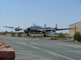
We drove the tree or so hours to Grand Canyon, South Rim, from Kingman, stopping briefly to admire the sculpture at one airport, and then at another to allow Rob's Dad to book tickets for a scenic flight over the canyon.
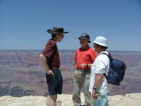
We spent the afternoon gazing at the canyon from a number of vantage points to the west of the entrance. The shuttle bus was very good.
We also went on a Rim walk with an NPS Ranger Keith Green, who explained the many life zones that exist in the canyon. The Riperion Zone is that next to the river which has the unique combination of heat (usually 30° F higher at the bottom of the canyon compared with the top) and water. Cottonwood grows there. There are desert alpine zones on the North Rim, and around the South Rim a lot of Pinon/Juniper Zones where the Pinion Pine and Utah Juniper grow. Keith pointed out different plants as we walked and when unable to immediatly identify them, pulled out a reference from his backpack enabling those with better eyesight to make the identification. He also pointed out groves of fir trees growing in shaded spots one 'level' down from the top of the canyon. The canyon sides are not always vertical and in places there are gentle (and not so gentle) slopes, which are able to support trees and other plants. The deeper into the canyon, the hotter it gets and so the desert plants are seen.
We watched the sunset from Yavapai Point, close to where we had seen it in
October with the Mulders. Afterwards we went to the auditorium where the same NPS Ranger Keith gave a slideshow on the history of Phantom Ranch, the buldings at the bottom of the Grand Canyon. Before the slideshow as people were arriving he told stories about the Hoop Snake (it grabs its tail and cartwheels down hills to snare its prey - appears without warning and is very dangerous :-), and Stick Lizards who carry around a stick in their mouth so when the ground is too hot to stand on, they stick the stick in the ground and stand in its shadow.
Phantom Ranch is an amazing place, there is enough accomodation and eating facilities for over 100 people. They instigated a reservation system to limit the number of people to a manageable number - the weekend before it was introduced, a thousand people (including lots of hippies) camped out there.
All the supplies, excluding water but including fuel oil for heating and cooking must be carried in by mules, and this is done daily. Even though it is a 9 mile walk or mule-ride to get there, and the same back out (and a mile climb in altitude) it is booked out months in advance. After watching Keith's slideshow we really wanted to go and experience it ourselves, but the walk out would be the killer.
Keith showed slides of the different bridges that have been constructed over the Colorado River at the bottom of the canyon for foot traffic. The current bridge was contructed in the 1930s and at one end a tunnel through the canyon wall was required to get onto it. There are stories of hikers who, arriving at the bottom of the canyon on a wet night, decide to sleep in the shelter of the tunnel and finish their journey in the morning. They are then rudely awakened by an unrecognisable noise which approaches through the tunel. Of course, the stories tell of screams of pandemonium, because early every morning the mule train comes down the canyon as early as possible to avoid travelling in the heat of the day. Imagine a tunnel, just wide enough for one mule, full of screaming people and panicking mules ...
Tuesday 27th April
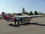
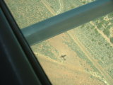
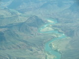
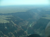
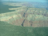
After enjoying the hotel's "free breakfast" of donuts and juice (accompanied by our own cereal), Rob and Rob's parents arrived at the airport at 8:20am and close to 9am were met by Melissa, their ~21 year old pilot and were escorted to a 4-seater Cessna for the trip over the Grand Canyon. Jo had decided against going up in an aircraft - had she come a different aircraft would have been required as there were no seats to spare! Rob sat in the copilots seat. The view from the air was amazing. We could see Mount Henry with its snow capped peak, NPS burn offs, and the land before the rim seemed so flat. However, once over the rim it was a different story, with Melissa pointing out different parts of the canyons whilst we clicked away with our cameras. The plane flew east above the canyon then north across the canyon, went across the North Rim, and then south back to the airstrip. There was still snow in places on the North Rim, though the sections of the road we saw were clear, as would be expected given it was opening again in a week or two (mid May). We could see the Colorado, and some of its tributaries - one of which appeared bright blue due to the dissolved copper compounds.
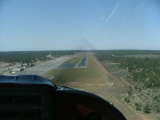
The little Cessna was surprisingly stable for an aircraft its size. It landed genly and we all were feeling great.
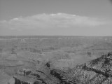
After collecting Jo who had been scouring the Tusayan shops for souveniers, we went and looked at a lookout east of where we had been the previous day before catching the shuttle to Yaki Point.
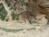
From Yaki Point, we walked down the South Kaibab trail to Oh Ah Point, the first point on the trail where it is possible to see both east and west along the Canyon. The walk down was pretty easy - being all down hill. The path was used for Mule trains and had evidence of this scattered in many places. We saw many other people on the trail, some who had been all the way to the river, and others, like us, who were just going for a taster. It was quite awesome walking down into the canyon as, for the first time, it was possible to get a better sense of the enormity of it, especially the height. We ate lunch at Oh Ah Point, where a number of other parties were also stopped. The view was excellent - a nearly 180° view of the Grand Canyon. It was also impressive looking back up at where we'd come from, especially the switch backs tat come down the steepest section. From Oh Ah Point we were also able to see where the trail continued, and we were told that the next bit, which we weren't going to do, was the steepest section the whole trail. We could also see the next stopping point - a toilet block and mules tied up near one. We were somewhat suprised that our return journey up the trail took only about as long as our walk down had, but we soon realised that we'd had many more photo stops on the way down.
Whilst eating our lunch on the rocky outcrop at Oh Ah Point we had to keep an eye on the squirrel who was very used to humans and who wanted our food - we saw first hand the problem caused by people feeding the wild animals. The squirrel was quite sneaky, trying to approach from different angles. It had the height advantage with Rob as it clambered up rocks behind where he was sitting and looked like it might even make a dive for his plate.
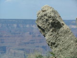
After we returned to the Canyon Rim we took the shuttle to the next view point, had a look, and then collected the car and drove further east stopping at view points, or overlooks as they are also known here. We also stopped at the Tusayan Ruin and Museum where there are the remnants of buldings built around 800 years ago by Native Americans. There was an interesting museum explaining some of what had been found in archaelogical digs, and showed how the inhabitants had grown corn and how they would store it for winter.
The most eastern point we stopped at was at The Watchtower. It had closed for the day, but we were going to come past the day after, so we watched the sun start to set from the lookout at its base. We drove back towards the centre of the park and stopped at Grandview Point to watch the sunset.
One enjoyable part of travelling is the short conversations with people participating in the same activity - people sitting watching the sun set, people on a trail, people on a shuttle bus. It adds to the experience
Wednesday 28th April
Wednesday was a driving day. We were headed for Bryce Canyon via Glen Canyon and other stops along the way. We stopped at the Watchtower and took a look inside. It was covered inside on the walls and ceiling with Native American paintings. It was quite fascinating to look at, and was a contrast from the outside. The Watchtower is at the eastern entrance of the National Park. Past that we continued eastward into Hopi and Navaho Indian Land.
There were some great views of another Canyon, much smaller, but looking like a gash through the otherwise flat landscape. We also stopped to buy souveniers from some of the many roadside stalls.
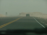
It was quite windy and once travelling north we went through some areas that looked like the Painted Desert (an area further to the east where we had been
previously). The wind picked up dust and sand and blew it across the highway, though this was only for short sections and we didn't lose too much visibility, though the road seemed to disappear in places. We stopped at the Navajo Bridge, or bridges, to take a breath and let Rob's parents take a look at the amazing Glen Canyon.
We then drove to Page and ate lunch at an outlook over Glen Canyon and the Glen Canyon Dam. This was quite a different view from what we had seen before. The wind continued unabated and so when we arrived at the Glen Canyon Dam and Power Station and asked about tours, we were told that it had been cancelled due to the strong winds. We had a good look around the museum and watched a video presentation before starting on the final leg to Bryce Canyon.


 We drove the tree or so hours to Grand Canyon, South Rim, from Kingman, stopping briefly to admire the sculpture at one airport, and then at another to allow Rob's Dad to book tickets for a scenic flight over the canyon.

 After enjoying the hotel's "free breakfast" of donuts and juice (accompanied by our own cereal), Rob and Rob's parents arrived at the airport at 8:20am and close to 9am were met by Melissa, their ~21 year old pilot and were escorted to a 4-seater Cessna for the trip over the Grand Canyon. Jo had decided against going up in an aircraft - had she come a different aircraft would have been required as there were no seats to spare! Rob sat in the copilots seat. The view from the air was amazing. We could see Mount Henry with its snow capped peak, NPS burn offs, and the land before the rim seemed so flat. However, once over the rim it was a different story, with Melissa pointing out different parts of the canyons whilst we clicked away with our cameras. The plane flew east above the canyon then north across the canyon, went across the North Rim, and then south back to the airstrip. There was still snow in places on the North Rim, though the sections of the road we saw were clear, as would be expected given it was opening again in a week or two (mid May). We could see the Colorado, and some of its tributaries - one of which appeared bright blue due to the dissolved copper compounds.


 It was quite windy and once travelling north we went through some areas that looked like the Painted Desert (an area further to the east where we had been previously). The wind picked up dust and sand and blew it across the highway, though this was only for short sections and we didn't lose too much visibility, though the road seemed to disappear in places. We stopped at the Navajo Bridge, or bridges, to take a breath and let Rob's parents take a look at the amazing Glen Canyon.