Thursday 29th April
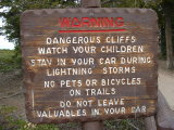
After complete confusion over time zones (Arizona doesn't have Daylight Savings and so is the same time as California during the summer. Utah does and is an hour ahead - Arizona and Utah would be the same time and an hour different to California during winter - they are east. Confusing isn't it.) and what time we were meeting for breakfast in our room, we drove into Bryce Canyon National Park. Whilst waiting at a road construction zone, we were kindly informed that it was best to drive all the way through the park to the end of the road "Rainbow Point" and then stop at each lookout on the way back, because they were all right turns off the park road, so we followed their advice and once at Rainbow Point rugged up (it was cold, ~ 0° C) and went to take our first look at the Canyon.
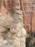
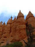
It is impossible to adequately describe Bryce Canyon, but the tall rock pillars are known as HooDoos,
and they are a feature of the park, as is the orange rock from which they have been carved by wind, water and the changing seasons. It was cloudy at Rainbow Point and soon started to gently snow. Rainbow Point elevation is 9115 feet (2778m) above sea level. We went for a walk on the Bristlecone Pine trail which was covered in a couple of inches of snow in places and the snow started to fall more, and was settling on the ground. We couldn't see a lot from the various lookouts we stopped at, but we did see the hardy, very old and slow growing Bristlecone Pine. It was very pretty with all the snow falling.
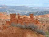
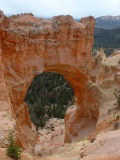
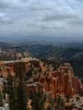
We drove back through the park stopping at lots of lookouts. The Canyon varies greatly between one end and the other and it was impossible to capture the amazing variety of formations with the camera. In places there were pillars everywhere, other places narrow slots between the towering rock (or mini canyons).
Friday 30th April
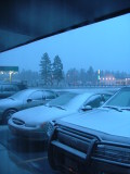
We awoke to find it snowing and a couple of centimetres had settled on the car and the ground. We waited around in our hotel, playing a card game until it had stopped snowing. By the time we were ready to leave the morning sun had melted most of the snow on the bitumen and car, but there was plenty still to be seen.
We drove to Sunset point to walk the Navajo and Queens Trail combination. The guide books recommend walking the Navajo trail into the Canyon and the less steep Queens trail back out.
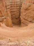
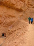
The Navajo trail descends into "Wall Street" via a number of switchbacks. The ground is a strong orange colour. It was quite cold at the top of the trail and we had been warned there might be snow on the trail but there was very little, and also very little mud. Once out of the wind we warmed up a little. The trail had been cut through some rock pillars in places. Wall Street is a slot Canyon and it was amazing walking between these towering pillars of orance and white rock. On the downhill end of Wall Street were a number of Cypress Pines growing from the floor of the Canyon. They were devoid of branches until quite a height.
The Navajo trail loops back to the Sunrise Carpark past the Two Bridges.
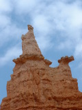
We walked as far as the two bridges (complete with warning signs to stop people climbing on them) formed by erosion on the top and underside of a harder section of rock. We then continued along the trail near the valley bottom in which a seasonal river (Yellow River) flows. Soon we were at the Queens Trail and looking up at what appears to be a statue of Queen Victoria, all formed through the errosion of a Hoodoo; quite amazing. The trail up to the Canyon Rim had some great views and a number of short tunnels dug through the rock. Other than the odd pine, the canyons are very barren and this allows the colour of the rock to sand out; all range of oranges and whites.
We visited another couple of lookouts and then drove out of the park and then into the Park's Northern end to see the Moss Cave. We walked to Moss Cave where there is steady but slow stream of water percolating through the sandstone. Inside the cave were ice columns which were formed by the dripping water freezing as it fell through the air. As it was warmer outside, the ice was melting, though it was still quite cold in the cave. We walked further up the Canyon to a waterfall but there wasn't much water coming over it.
That night after dinner, Jo and Rob went to watch the sunset, but were too late - the sun may not set until after 8pm, but it stops shining on the Canyon much earlier due to the high mountains. So Jo suggested we stay and see if the skies in Bryce really are the darkest in the country at night. There was a half-moon that night and after 1/2 to 3/4 hour we could see the Canyon lit only by moonlight, and many stars in the sky. We played around with the camera and then went to Sunrise Point as we thought we might have been able to capture something there. Each full moon an NSP ranger holds a moonlight walk and by what we could see, it would be a magnificent experience.


 After complete confusion over time zones (Arizona doesn't have Daylight Savings and so is the same time as California during the summer. Utah does and is an hour ahead - Arizona and Utah would be the same time and an hour different to California during winter - they are east. Confusing isn't it.) and what time we were meeting for breakfast in our room, we drove into Bryce Canyon National Park. Whilst waiting at a road construction zone, we were kindly informed that it was best to drive all the way through the park to the end of the road "Rainbow Point" and then stop at each lookout on the way back, because they were all right turns off the park road, so we followed their advice and once at Rainbow Point rugged up (it was cold, ~ 0° C) and went to take our first look at the Canyon.
 and they are a feature of the park, as is the orange rock from which they have been carved by wind, water and the changing seasons. It was cloudy at Rainbow Point and soon started to gently snow. Rainbow Point elevation is 9115 feet (2778m) above sea level. We went for a walk on the Bristlecone Pine trail which was covered in a couple of inches of snow in places and the snow started to fall more, and was settling on the ground. We couldn't see a lot from the various lookouts we stopped at, but we did see the hardy, very old and slow growing Bristlecone Pine. It was very pretty with all the snow falling.


 We awoke to find it snowing and a couple of centimetres had settled on the car and the ground. We waited around in our hotel, playing a card game until it had stopped snowing. By the time we were ready to leave the morning sun had melted most of the snow on the bitumen and car, but there was plenty still to be seen.
 The Navajo trail descends into "Wall Street" via a number of switchbacks. The ground is a strong orange colour. It was quite cold at the top of the trail and we had been warned there might be snow on the trail but there was very little, and also very little mud. Once out of the wind we warmed up a little. The trail had been cut through some rock pillars in places. Wall Street is a slot Canyon and it was amazing walking between these towering pillars of orance and white rock. On the downhill end of Wall Street were a number of Cypress Pines growing from the floor of the Canyon. They were devoid of branches until quite a height.
 We walked as far as the two bridges (complete with warning signs to stop people climbing on them) formed by erosion on the top and underside of a harder section of rock. We then continued along the trail near the valley bottom in which a seasonal river (Yellow River) flows. Soon we were at the Queens Trail and looking up at what appears to be a statue of Queen Victoria, all formed through the errosion of a Hoodoo; quite amazing. The trail up to the Canyon Rim had some great views and a number of short tunnels dug through the rock. Other than the odd pine, the canyons are very barren and this allows the colour of the rock to sand out; all range of oranges and whites.