Death Valley
Friday 13th February
On the way to Death Valley we briefly stopped at Red Rock Canyon National Park, where Rob had been with Hai-tan earlier in the week of their way back from China Lake. This time, we didn't take many photos - another time we will need to stop and do so.
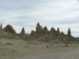
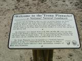
We stopped for lunch at the Trona Pinnacles - calcium carbonate deposits on an otherwise flat valley which are many metres tall. We will have to take a look around more next time. Trona Pinnacles have been used in many films because of the alien landscape appearance.
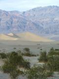
Finally made it to Death Valley National Park, at the main visitor's center Furnace Creek at around 4pm, and obtained maps and suggestions for sunset - Dante's View, if we had warm clothes. Furnace Creek is 196 feet below sea level, and Dante's View is approximately 5,500 feet elevation.
Forty minutes later, we were standing, rugged up, admiring the view of Death Valley - what an introduction - we could see the snow covered mountain range defining the western border of the valley, the deep and salt covered valley floor with all its intriguing patterns and colours. We were standing on a peak on the eastern side of the valley. We walked to the south a short distance to get better views as the sun set - the mountains provided a large obstacle to the sun, but after disappearing behind the mountains the sun started to illuminate the mountains to the east of us!
Once the sun had completely set (or we'd become too tired), we drove across the mountains and a small valley to Beatty, where our accommodation was. We had been unsuccessful in finding accommodation in Death Vally itself, all of the rooms had been booked. When driving past Furnace Creek we noticed signs indicating the campgrounds were also booked out - we had chosen a popular weekend to visit Death Valley! As it was, we had booked the last available room in the El Portal Motel. We get the impression that Beatty's industries are tourism, casinos and mining. It certainly had a mining town look about it, and not just the bare hills like Queenstown, Tasmania. The town had a 'ramshackle' look about it.

Saturday 14th February - Valentine's Day
We wanted to see a sunrise and decided to do that Sunday morning, and so after rising not too early we set off to see Scotty's Castle aiming to get there before the crowds. We stopped to get petrol and whilst filling the tank, Rob went to wash the windscreen but gave up after discovering the water frozen over in the washer bucket. It is a long drive through the valley to Grapevine Canyon where Scotty's, or should we say The Johnson's, Castle is. The basic history is:
Scotty was a great story teller and convinced Johnson (and many others) that he had a gold mine in Death Valley. 
 This story provided Scotty with income as he constantly needed money from his backers to develop the mine and to deal with the difficulties of supposedly mining Death Valley. Anyway, Johnson one day come to Death Valley, and whilst never actually seeing the mine, liked the place so much and liked Scotty as well, that he bought up land and over time built the Castle as a winter retreat. Unfortunately he suffered monetary losses during the depression and the swimming pool and grounds were never finished. Scotty and the Johnsons became good friends and they spent many an evening listening to Scotty's tales. After the Johnsons had died, Scotty came to live in the castle.
We were taken on a tour of the castle as it would have been seen in 1939, by a Park Ranger in period costume. The castle contains a number of items related to the fact that Mr Johnson was an engineer and he and his wife were musicians and lay Baptist preachers:
- Pipe Organ
- in their own Chapel
- Piano
- actually, a Baby Grand Pianola
- Chime Tower
- 25 bells/chimes controlled from the music room via a small piano keyboard. It could be set to play a tune, like a pianola, when the door bell was pressed.
- Solar Hot Water
- except it was ruined in the first winter due to the pipes freezing and splitting.
- Pelton Wheel Generator
- the springs which supplied water to the castle and grounds, also drove the electric generator, charging batteries and providing electricity to the house.
- Aerated Cement Block Insulation
- cement mixed with sodium bicarbonate (baking soda) provided a light-weight pumice-like brick which was built into the walls to insulate the house.
- Water Falls
- in a number of rooms there were water fountains (the one in the lounge doubled as a fireplace) to provid evaporative cooling in the hotter months.
There was also an engineering tour but we didn't have time go on it.
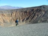
We bought some overpriced sandwiches from the cafe and drove to the Ubehebe crater. The crater was created approximately 6000 years ago by magma rising and meeting the ground water and causing a massive steam explosion. It was about .8 miles across and 500 feet deep. Armed with our lunch, we walked up along the crater's rim to the Little Hebe crater and ate whilst enjoying the view. Rob contemplated walking into the Ubehebe crater but decided to save his energy.
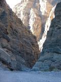
We drove to Titus Canyon, which can be driven through in a car (4WD), but only from east to west, and it was closed due to mud. We parked at the western end and walked east. We had not read the book correctly and were aiming for a dry fall (ie a waterfall but without water most of the time) and petroglyphs. After walking through this narrow, steep walled canyon for about an hour, we turned around. Later we discovered we were in the wrong canyon for the dry fall and petroglyph's, but that Titus Canyon was the more magnificent. As we had discovered on our Canyon trip last year, the canyons are often more interesting and impressive when seen from the inside. This one certainly was amazing.
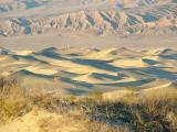
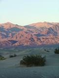
It was getting late and we drove to the Sand Dunes having read they offer good views at sunset. Well, we arrived there a bit late, and missed out on anything much. So, after trudging back through the sand we drove to Furnace Creek. Seeing only large lines for the only eateries, we went into the shop and bought microwave meals and made use the shop's microwave oven. After eating the chicken pot pie and lasagna with some foul-tasting bread, we went to an evening talk/slide show at the National Park Service (NPS) auditorium.
There were about 100 people there. An NPS ranger (Chris) first asked where the audience had been that day, and then whether it was their first trip, and if not, for how many years have people been coming to Death Valley National Park - one guy had been coming since midway through the last century - well over 50 years! The ranger then showed slides of great walks in the park. From easy 1 hour walks to mammoth overnight hikes to the top of Telescope Peak. He had some great slides and beautiful views, sunrises and sunsets. He encouraged us to just get out of the car and explore; to see a place and say "I'm going to take a look". He told us about rattlesnakes and how to avoid being bitten (just don't pick them up). He reminded us it was a National Park and nothing should be taken home. We really enjoyed it. After the slide show/talk, it was 40 miles back to the motel for an early night.
Sunday 15th February
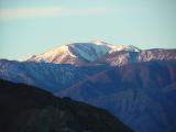
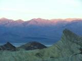
The alarm woke us at 5am and we dragged ourselves out of bed and were on the road a little after 5:30am. We drove into Death Valley and along and up to Zabriskie's Point. Well, actually to a point where we could view Zabriskie's Point. Light was appearing and we arrived about 6:30am. With so many mountains in the way, it took a while to actually see the sun directly shining on anything, and it started at Telescope Peak and worked its way down over more than half an hour to eventually shine on Zabriskie Point. We were surprised by the number of people who had also come to watch, and by the number of tripods erected, to photograph the sunrise. Whilst not a colourful sunrise, seeing the first light on the mountains and hills was worth rising early for.
After the sun rose, we drove through 20 Mule Team Canyon. This Canyon was more of a valley between large hills and quite small yellowish-hills. We took the Ranger's suggestion to heart and part way through the canyon parked the car and went exploring. We had seen what looked like caves, so we went to look - they were mine shafts, and whilst poking our noses in, noticed that they were warmer inside and a bit smelly - the signs outside each warned against entering. We clambered up over these small yellow hills/mounds and then walked along a ridge looking down into another valley. It was in this area that the "Jabba the Hut" scenes in "Star Wars" were filmed - it was completely free of plants. We later learnt that the miners were looking for Borax when they dug these mines.
Fortunately we had brought the laptop with us as so we could download our photos, as we had filled up the camera's card before 8:30am.
At 9am we met a NPS Ranger (same guy as gave the slide show/talk on Saturday night) at the side of the road, near Golden Canyon for a geology hike.
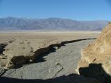
We were part of a group of 28 who had come to enjoy the guided walk. The Ranger started by reminding us we were in a national park, and that all the rocks had a common name - "Leaverites", as it "leave-er-rite here", and that whilst we would be climbing some dry falls, it would not be a difficult walk. He led us up a canyon which had experienced some major changes over the last 100 years. At the mouth of all canyons in Death Valley there are silt fans, but this one was unique in that the fan had a 2-3 metre deep channel, maybe 10 metres wide running from the mouth of the canyon. As the Ranger told us later, this was caused by a significant increase in water during the last century, caused by the diverting of another dry stream into this canyon. This diversion was built by miners after a downpour caused water to wash through the Furnace Creek Inn carpark, carrying away a lot of nice cars. This was before the area became the National Park - they almost never do this now, and would have removed the river diversion, except there are no problems in terms of wildlife or plantlife with leaving it how it is now.
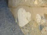
Anyway, we walked up the canyon, past a dry falls, and stopped at different places to: observe how high the water had been in the August 2003 storm; huge overhanging rocks waiting for the next storm or earthquake to fall; see the layers in the sedimentary rock and how they had been uplifted; see heart shaped rocks in conglomerate rocks in the wall of another dry falls.
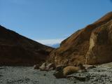
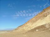
After walking (and stopping) for about 1 ¾ hours, we came to a mine adit, where we were told more about the history of borax, silver and gold mining in Death Valley, and how borax underground mining still continues, but only because it is underground and doesn't damage the National Park. Our ranger told us that in general mines are unsafe (hence the signs posted at their entrances) but he felt we would not be in any danger (other than hitting our heads on the low ceiling) in this mine as it was short (10 metres long) and in stable ground. However, he was giving no guarantees and we would go in at our own risk. So, we had a look. We asked the Ranger more about rattlesnakes, and after realising we weren't worried about them, and were Australians, he answered our antivenin and "how poisonous are they" questions. We then followed him, at an increasing distance due to our photo stops, the mile or so back down the canyon to the car.
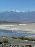
We then travelled to Badwater, the lowest point in the USA (and the western hemisphere!) at -282 feet. We had a look around and then ate lunch. After eating and removing excess clothing, we walked out across the salt flats and looked at the amazing salt crystals and patterns in the mud. It was hot, at least 30°C we thought, quite a contrast with what it had been when we watched the sunrise. The mud and salt hardens and expands and this causes it to push up and cracks form.
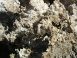
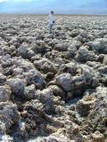
We then drove to the Devil's Golf Course where there were taller and quite different salt formations. The sign in the carpark warned that falling could result in cuts and even broken bones. The salt was hard, and somehow, probably wind and rain, had caused it to form knife edges in a corrugated pattern. Taking pictures was quite precarious at times. There were some fascinating little caves which looked like an ice cave from Superman or a recent James Bond movie, except in miniature.
Our next drive was through Artist's Drive, and onto Artist's Palette. Here, minerals colour the volcanic deposits, causing an "Artist's Palette" of colour - reds, pinks, yellows, green and purple.
Having had little success the previous afternoon, we drove to the sand dunes and walked half a mile out to an area less trampled and took photos of the sand waves as the late afternoon sun provided great shadows and contrasts. We saw lots of animal tracks - more likely to have seen the animals in early morning. There were what looked to be kangaroo rat, lizard and bird prints.
Once we had enjoyed the sunset we returned to Beatty for an early night.
Monday 16th February
Before departing Beatty we quickly visited Eddieworld, part of which is the largest candy store in Nevada - that doesn't mean it was particularly large, and they had more shelf space devoted to bottled and boxed water than chocolate. We did find some more unusual sweets, one of which were Lego-like candies, another was chocolate coated cookie dough balls - like chocolate sultanas, but cookie dough.
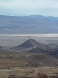
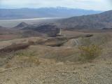
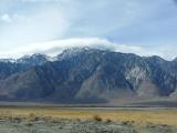
We drove back to LA via Panamint Springs - a small town on the hills overlooking the Panamint Valley. Further on we came to a lookout from where we could look back across Panamint Valley - which is one valley west of Death Valley. Then it was down into the valley where China Lake is. The valley is bordered by the Sierra Nevadas, and we stopped to take in the view - the huge mountains rising from the flat valley floor, like a huge snow-capped wall. We know that Mount Whitney (tallest mountain in the 48 contiguous states) was there but we didn't know which one from looking.
We reached the 395 highway where we discovered what we had been dreading - the long weekend ski traffic also returning to LA. The highway at that point was only one lane each direction and it was solid going south, so we turned north and stopped to find a toilet and food. We joined a queue for the former and then decided against joining a queue for the latter. When crossing the road back to the car, we spied a break in the south-bound traffic and stopped halfway across the highway, as Australians are inclined to do, but as Americans don't seem to expect, as seen from the screeching of tyres and subsequent crash-avoidance methods employed by the drivers. Fortunately, we made it to the other side unscathed, and no drivers suffered more than elevated heart rates. We somehow found a gap in the traffic and, now in the car, joined the traffic streaming homeward.
We stopped at Inyokern a short detour off the freeway to find food unsuccessfully and had to wait until the Mojave, where we joined the food and toilet queues in a Subway. The rest of the drive home was pretty uneventful, a good finish to a most memorable weekend.
We travelled a total of 1040 miles.


 On the way to Death Valley we briefly stopped at Red Rock Canyon National Park, where Rob had been with Hai-tan earlier in the week of their way back from China Lake. This time, we didn't take many photos - another time we will need to stop and do so.

This story provided Scotty with income as he constantly needed money from his backers to develop the mine and to deal with the difficulties of supposedly mining Death Valley. Anyway, Johnson one day come to Death Valley, and whilst never actually seeing the mine, liked the place so much and liked Scotty as well, that he bought up land and over time built the Castle as a winter retreat. Unfortunately he suffered monetary losses during the depression and the swimming pool and grounds were never finished. Scotty and the Johnsons became good friends and they spent many an evening listening to Scotty's tales. After the Johnsons had died, Scotty came to live in the castle.
 We bought some overpriced sandwiches from the cafe and drove to the Ubehebe crater. The crater was created approximately 6000 years ago by magma rising and meeting the ground water and causing a massive steam explosion. It was about .8 miles across and 500 feet deep. Armed with our lunch, we walked up along the crater's rim to the Little Hebe crater and ate whilst enjoying the view. Rob contemplated walking into the Ubehebe crater but decided to save his energy.
 We drove to Titus Canyon, which can be driven through in a car (4WD), but only from east to west, and it was closed due to mud. We parked at the western end and walked east. We had not read the book correctly and were aiming for a dry fall (ie a waterfall but without water most of the time) and petroglyphs. After walking through this narrow, steep walled canyon for about an hour, we turned around. Later we discovered we were in the wrong canyon for the dry fall and petroglyph's, but that Titus Canyon was the more magnificent. As we had discovered on our Canyon trip last year, the canyons are often more interesting and impressive when seen from the inside. This one certainly was amazing.
 It was getting late and we drove to the Sand Dunes having read they offer good views at sunset. Well, we arrived there a bit late, and missed out on anything much. So, after trudging back through the sand we drove to Furnace Creek. Seeing only large lines for the only eateries, we went into the shop and bought microwave meals and made use the shop's microwave oven. After eating the chicken pot pie and lasagna with some foul-tasting bread, we went to an evening talk/slide show at the National Park Service (NPS) auditorium.
 The alarm woke us at 5am and we dragged ourselves out of bed and were on the road a little after 5:30am. We drove into Death Valley and along and up to Zabriskie's Point. Well, actually to a point where we could view Zabriskie's Point. Light was appearing and we arrived about 6:30am. With so many mountains in the way, it took a while to actually see the sun directly shining on anything, and it started at Telescope Peak and worked its way down over more than half an hour to eventually shine on Zabriskie Point. We were surprised by the number of people who had also come to watch, and by the number of tripods erected, to photograph the sunrise. Whilst not a colourful sunrise, seeing the first light on the mountains and hills was worth rising early for.
 We were part of a group of 28 who had come to enjoy the guided walk. The Ranger started by reminding us we were in a national park, and that all the rocks had a common name - "Leaverites", as it "leave-er-rite here", and that whilst we would be climbing some dry falls, it would not be a difficult walk. He led us up a canyon which had experienced some major changes over the last 100 years. At the mouth of all canyons in Death Valley there are silt fans, but this one was unique in that the fan had a 2-3 metre deep channel, maybe 10 metres wide running from the mouth of the canyon. As the Ranger told us later, this was caused by a significant increase in water during the last century, caused by the diverting of another dry stream into this canyon. This diversion was built by miners after a downpour caused water to wash through the Furnace Creek Inn carpark, carrying away a lot of nice cars. This was before the area became the National Park - they almost never do this now, and would have removed the river diversion, except there are no problems in terms of wildlife or plantlife with leaving it how it is now.
 After walking (and stopping) for about 1 ¾ hours, we came to a mine adit, where we were told more about the history of borax, silver and gold mining in Death Valley, and how borax underground mining still continues, but only because it is underground and doesn't damage the National Park. Our ranger told us that in general mines are unsafe (hence the signs posted at their entrances) but he felt we would not be in any danger (other than hitting our heads on the low ceiling) in this mine as it was short (10 metres long) and in stable ground. However, he was giving no guarantees and we would go in at our own risk. So, we had a look. We asked the Ranger more about rattlesnakes, and after realising we weren't worried about them, and were Australians, he answered our antivenin and "how poisonous are they" questions. We then followed him, at an increasing distance due to our photo stops, the mile or so back down the canyon to the car.


 We drove back to LA via Panamint Springs - a small town on the hills overlooking the Panamint Valley. Further on we came to a lookout from where we could look back across Panamint Valley - which is one valley west of Death Valley. Then it was down into the valley where China Lake is. The valley is bordered by the Sierra Nevadas, and we stopped to take in the view - the huge mountains rising from the flat valley floor, like a huge snow-capped wall. We know that Mount Whitney (tallest mountain in the 48 contiguous states) was there but we didn't know which one from looking.
 We reached the 395 highway where we discovered what we had been dreading - the long weekend ski traffic also returning to LA. The highway at that point was only one lane each direction and it was solid going south, so we turned north and stopped to find a toilet and food. We joined a queue for the former and then decided against joining a queue for the latter. When crossing the road back to the car, we spied a break in the south-bound traffic and stopped halfway across the highway, as Australians are inclined to do, but as Americans don't seem to expect, as seen from the screeching of tyres and subsequent crash-avoidance methods employed by the drivers. Fortunately, we made it to the other side unscathed, and no drivers suffered more than elevated heart rates. We somehow found a gap in the traffic and, now in the car, joined the traffic streaming homeward.